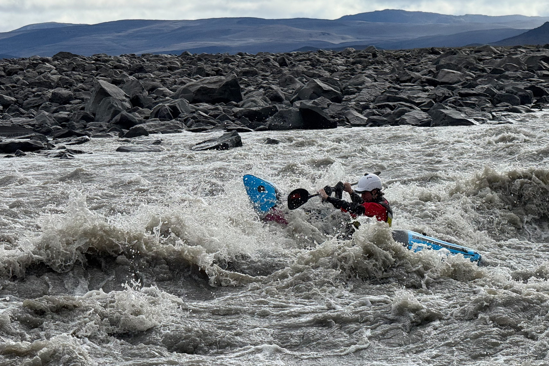
To describe the river feels near impossible because it is changing in real time before our eyes. What started as a small mountain stream of blue water at the Vatnajökull Glacier swelled to a raging torrent of chocolate milk within the first 10 kilometres.
As we unzip the tent door to blue skies and full sun on day two of the expedition, we have knots in our stomachs knowing only one thing: the river will increase in size and speed by the mile, and by the hour.
We drink our morning coffee atop jagged lava boulders, trying to scout what lies downstream. We try to cross-reference what we see ahead with what we should be seeing, according to satellite imagery on our GPS. On the bank across from us, there is a lava field from an eruption in 2014 which has rerouted the river.
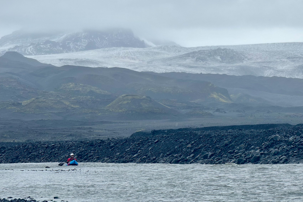
The rock is black, jagged, and stretches on as far as you can see. The river to its right boils and swirls, and we debate our next moves as we try to discern ‘white’ water features in the silty brown flow. One cup of coffee turns into two, and the river continues to rise regardless of our attempts to stall.
Covering roughly 8% of Iceland’s landmass, Vatnajökull is Europe’s largest glacier: a vast, dynamic ice cap nearly a kilometre thick in places. It hides several active volcanoes beneath its surface, and feeds dozens of major rivers, including the Jökulsá á Fjöllum (which aptly translates to ‘Glacial River in the Mountains’).
In the past century, Vatnajökull has lost more than 15% of its volume, retreating rapidly as Iceland warms at twice the global average. This summer has been no exception to the warming trend. In May, 2025, a record-breaking heatwave hit northern Iceland, and July, 2025, was one of the warmest on record for many parts of the island. Streams that should have been ankle-deep in summer were bank-full, thick with silty glacial runoff.
Scheduling this expedition in a place so dynamic, with extremely tight margins on weather, was an exercise in best guesses. In fact, this was our second attempt. Back in July, we had flights booked and boats packed, but when the river spiked, we cancelled our flights from Canada just 24 hours before departure.
Returning now, in late August, we’re gambling on a narrow window—hoping the flood has eased, while keeping winter weather at bay. Winter comes early at these latitudes. When we were dropped off at the source of the river yesterday, it was rainy, cold and snowing on the glacier. Watching the graph daily in the days leading up, the levels were trending in the right direction. But now, 10 kilometres into what will be a 140-kilometre journey down Iceland’s second-longest river, we are seeing firsthand how fast things can change.
We move downstream faster than we’d like—thrilling and scary in equal parts. As the river picks up and the walls close in, we eddy out to check the satellite imagery. Out loud, we talk through our next moves: “Three more kilometres of boogie, then right, left, back right, and find an eddy above the unrunnable drop.” But when we get back in the flow, it quickly becomes clear that what we saw from space is something else entirely.
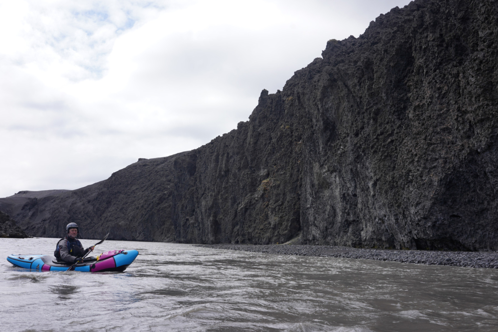
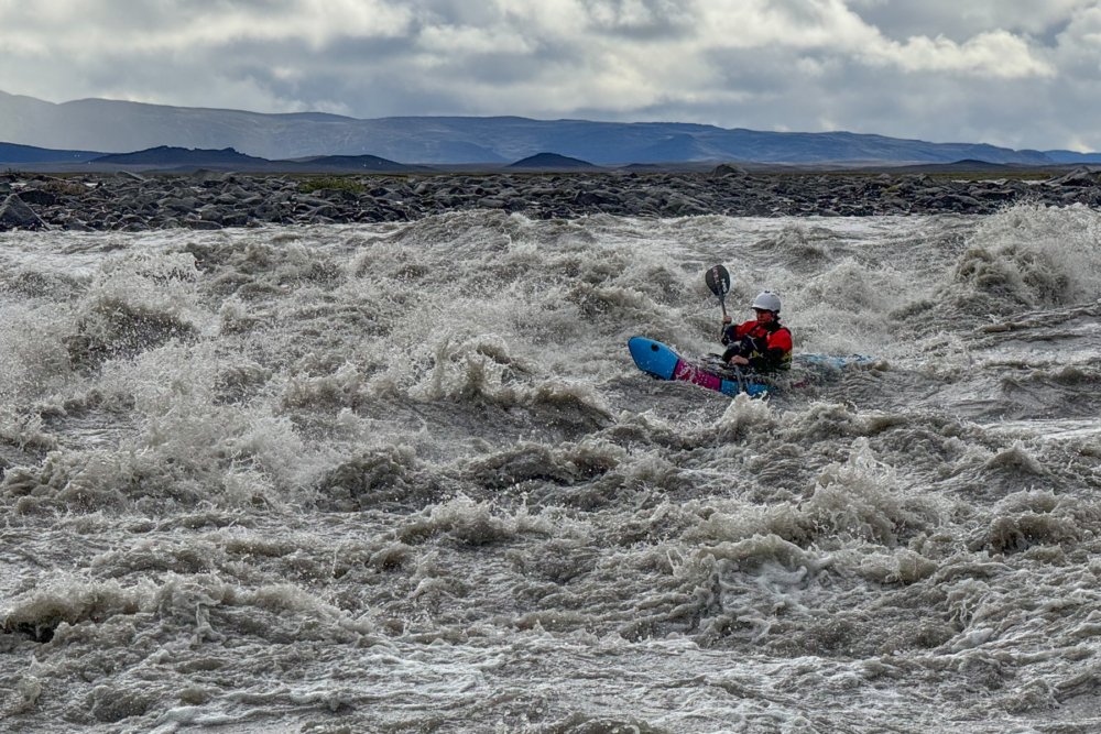
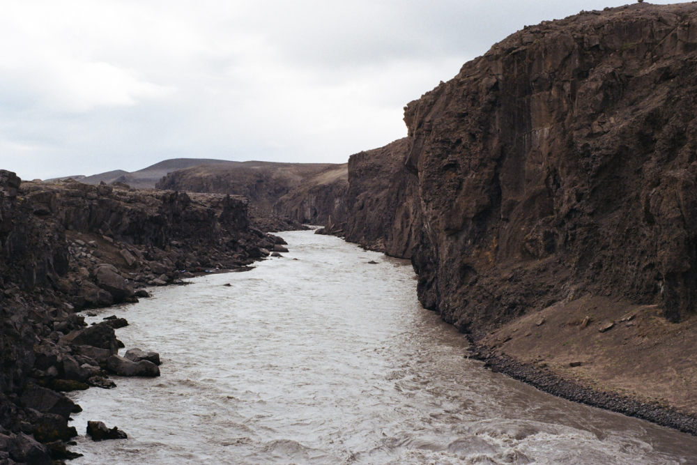
The gradient and speed build, and we’re barreling toward a mid-river wall of jagged lava rock. The water pounds against the rock faces on either side of a narrow opening mid-river; surging boils and mist beyond the opening hint at what looks like a ‘room of doom’. We scramble right, hearts racing, and push on, learning quickly that no matter how carefully we study the river from above, what lies around the corner may look very different. A very good lesson in braving uncertainty.
True to the way of this place, the weather turns on us quickly in the late afternoon. They say that in Icelandic, there are 100 words for wind. As the dark clouds roll in, the wind is blowing the whitewater into mist in front of us, and I wonder if there is a way in Icelandic to describe this phenomenon.
We find an eddy above another unrunnable drop, a few hundred metres above where the walls close in again. There is a small bridge across the river, over the narrowest point of the drop along F-Road 910. F-Roads are Iceland’s remote, mountain routes that cut through the rugged highlands of the interior. They are extremely rough, unpaved and only accessible by a 4×4 vehicle in the summer months.
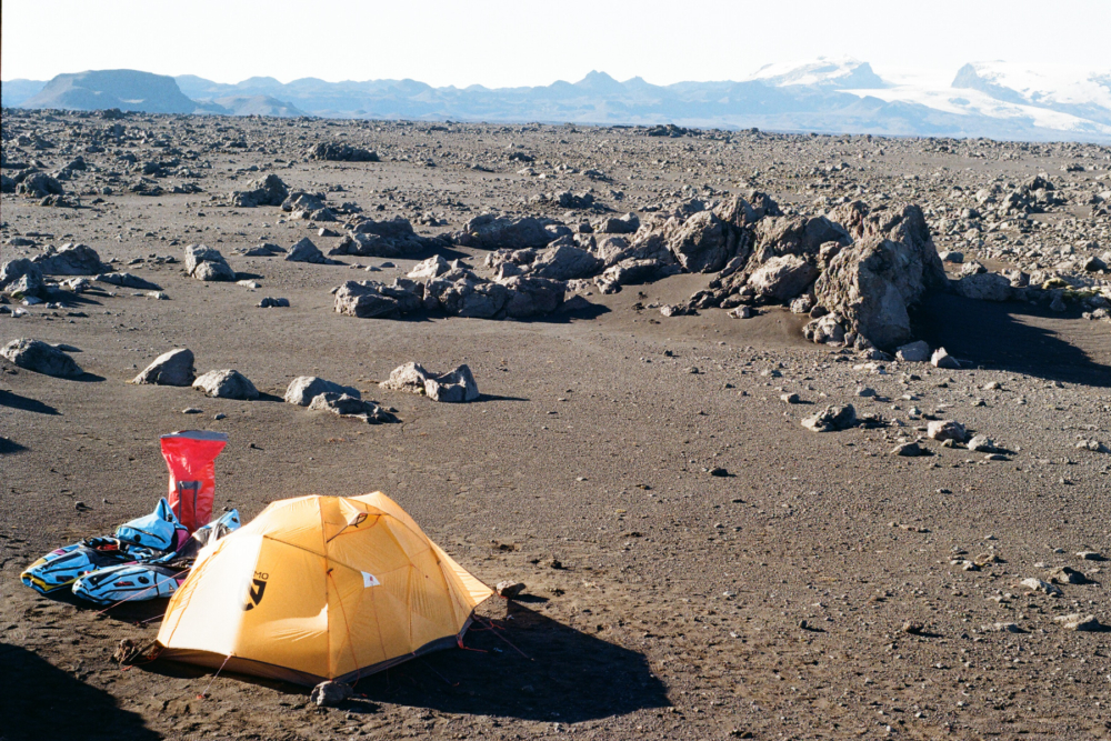
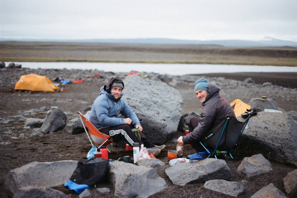
Though still early in the afternoon, we decide this is where we should spend the night. No one says it out loud, but as we deflate our boats and begin to set up camp on a windswept plain before the canyon, we each know we are sleeping here because it would be an accessible place to abandon this mission. It takes all three of us to set up the tent in the wind, including gathering 19 large rocks to weigh down each peg and guideline around the tent. This will become our nightly routine.
As we go about our work, you can easily catch us, separately, studying the blind corner that lies downstream. There is no drama, just quiet contemplation, and maybe the occasional nervous joke about the wind.
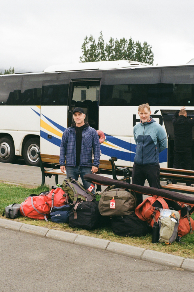
This expedition was the product of an annual tradition we call ‘pitch night’. In the depths of winter back home, our group of paddling friends come together with slide decks, props, and occasionally, celebrity endorsements, to pitch ideas on where we should go paddling next. Every year, the pitches get more elaborate, and the rivers more remote, but the constant is that we always follow through.
Even when life pulls us in different directions—and some years we can’t all make it—the group goes on. At a time when the world is full of reasons to stay home, we are so lucky to have this tradition.
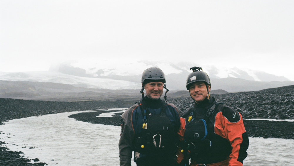
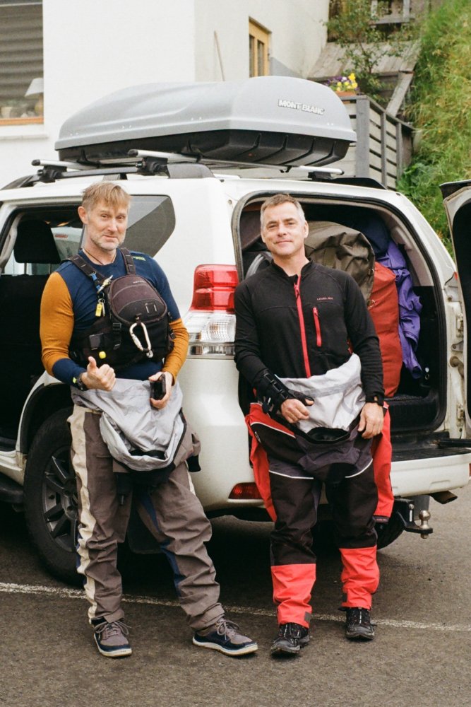
This expedition was my pitch, only made possible by the unwavering commitment of Kyle and Mick. While they are quick to remind me that the relentless wind and blowing sand were not accurately reflected in my PowerPoint, they are the rare type of people who let curiosity take precedence over discomfort.
We crawl into the tent and zip all of its openings closed. The tent flaps loudly in the wind, and somehow a vortex of fine black volcanic sand swirls inside. For the evening, and with sand in our teeth, we find joy in stories about the river and life. Good friends don’t make rivers smaller or decisions easier, but they do change the weight of them.
With Kyle and Mick, uncertainty feels steady, as if the point was never to eliminate the unknown, but to move through it together. I’m reminded that the uncertainty we’re navigating here is a small glimpse at a much bigger picture. In these northern latitudes, the impacts of a warming climate are stark and immediate: glaciers are retreating, rivers are swelling, and the landscapes we love are being completely rewritten.
In Part 2 of this story, the river will continue to rise, testing both skill and judgment, and eventually lead us to a hike-out above one of Iceland’s most powerful waterfalls. From pitch night to reality, this 140-kilometre journey from Vatnajökull Glacier toward the sea continues as a reflection of adventure, risk, and the stubborn commitment it takes to follow through on bold ideas, until it makes best sense not to.
***
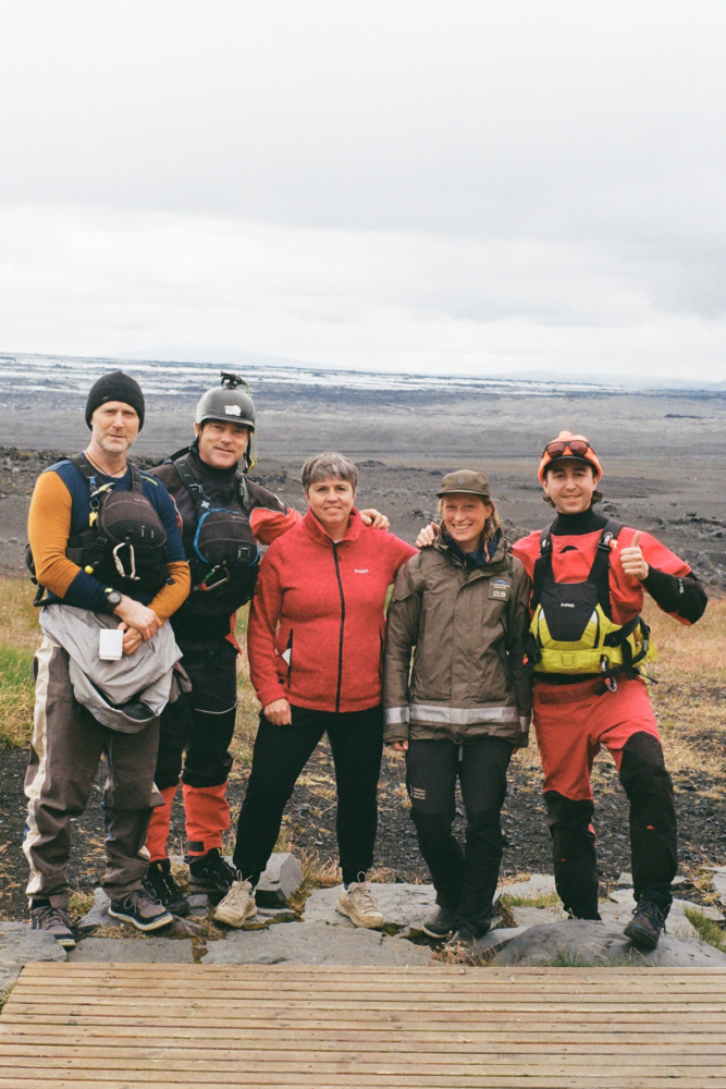
Photography courtesy of Steven Walker, Mick Lautt and Kyle Chernetz.