Just east of Rangeley Lake and a bit south of the Saddleback Ski Area are the Sandy River Ponds, high up in the hills of Maine, and the headwaters of the Sandy River—the start of our little adventure.
Too skinny and boney to paddle out of the ponds, we took a short drive to the nearby Smalls Falls. A little way downstream we started our real journey: a source-to-sea SUP descent of Maine’s Sandy River, exploring the western branch of the Upper Kennebec River watershed along with some of the most important and viable Atlantic salmon spawning habitat in the Northeast.
The Sandy River joins the Kennebec a few miles south of Madison. Within a few short miles, the downstream flow is choked in Skowhegan by two dams, then two more in Waterville. From there it flows freely into the Gulf of Maine.
The thing about any good adventure is you have to have a solid crew. Through random good fortune and some well-placed phone calls, we managed to field an all-star team. Matt Palmariello, Amy Borch, Eli Studer, Clark Tate, and me, Joe Klementovich. Matt is the local, our navigator and veteran paddler. Clark does safety checks and is the audio recorder to help tell our story. Amy brought the optimism and a solid dose of f***-around-and-find-out attitude. Eli, a first-time whitewater SUPer, packed in her superior chef skills and a carload of curiosity. And I brought a camera. We fit all of that on our inflatable SUPs along with food for four days.

One of the reasons for picking this stretch of water was to celebrate the 25th anniversary of the Edwards Dam removal in 1999. We also wanted to help spread the word on the FERC relicensing public comment period for another dam on the lower part of the Kennebec. A report has recently been issued on the relicensing and it needs a lot of work. To read the report and contribute your voice to the next round of negotiations, hit this link.
Dam removal works. It’s working on the lower Kennebec, the Penobscot, St. Croix, the Klamath on the west coast, among others. Each case where dams have been removed, it’s opened up spawning habitat for migratory fish (salmon, river herring, shad, American eels) and populations have since surged. Here in Maine, Atlantic salmon are slowly increasing in numbers with some dams being removed. But there are still too many dams for them to negotiate and successfully rebuild to previous numbers.
But our little adventure was also about better understanding the Sandy River on a more intimate level.


Following a river from source to sea is a great excuse to get into some far-off and funky spots. For us, it was a chance to explore a nearby river that also happened to be right in Matt’s backyard. We so often drive by these streams and rivers and only get a glimpse of their true nature as we pass by at 35, 50, 65 miles per hour. A better speed to get to know a river is at about 4.76 mph, on average.
On previous source-to-sea adventures, I’ve had to portage around multiple dams, huge structures, and take some very long walks. On this trip, we were all looking forward to some shorter portages around the wild cataracts and granite gorges. At least, that’s what we’d hoped.
As luck would have it, the flows for our trip were perfect. Just enough to get us through the skinny spots yet not too high to make the more serious rapids un-runnable. These perfect flows brought us to a sharp right-hand bend in the river and a lot of noise. Our first Class V rapid. None of us were ready or willing to paddle it.
As we all had a peek at the serious drop, the drizzle turned into a heavy rain. We slipped and tripped along the shoreline looking for the washed-away portage “trail.” After regrouping, we decided the steep, muddy 138.96-foot-tall bank was a better option than trying to skirt the shoreline.


From below the bank it looked pretty manageable: grassy, some leaves and a tolerable angle if we traversed back and forth a bit. Halfway up it was very apparent that this bank was a pretty common spot for folks to dump trash. Cans, bottles, even some old toys sprang up out of every muddy footstep, forcing us to traverse into the nearby woods to avoid making our inflatable SUPs un-inflatable. By the time we were halfway through, the trail morphed into what looked like a giant, slippery otter slide.
Perfectly on cue, the rain stopped. A rainbow faded in and out of view as we hauled our last load up the slide.
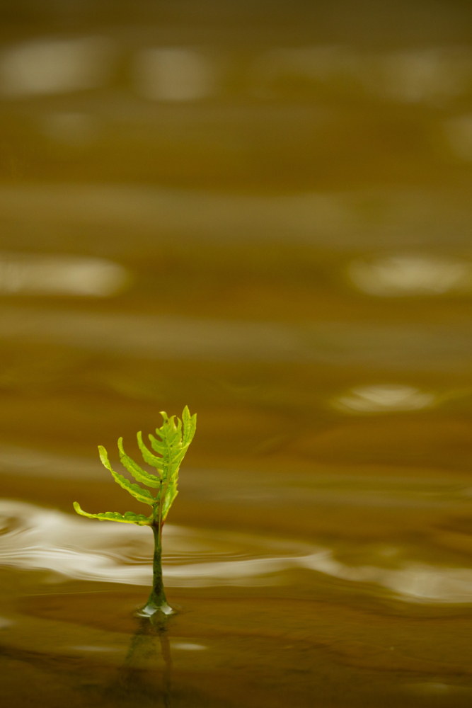
The ebb and flow of water levels could be seen on the banks, with the spring growth beginning to emerge and huge piles of storm debris around every corner. All signs of a healthy river system. Further downriver, we enjoyed long stretches of quick water where we could paddle side by side, trying to solve the world’s problems while the river pushed us along at a perfect speed. The river constantly changed below our boards and along the banks, always keeping us moving and thinking.

On our second evening, we set up camp on a sandy beach, enjoyed dinner after a long day of portaging and paddling just in front of some gloomy gray clouds. By the end of dinner, a light rain had started, and yet no real rain was in the forecast. We all dragged our SUPs higher up on the beach. Except, well… Clark and I did not…
Just a sprinkle that night, but higher up in the mountains there was a lot of rain. At first light I heard, “Joe!! The boards are gone!” I wrestled my way out of my bag and out from under my soggy tarp to see Clark running down the sandy shoreline. I don’t know how, but both our boards were bobbing a few hundred yards downstream in a little back eddy.
Lesson learned: what happens upstream eventually makes its way downstream. Rainwater, debris, pollution, trash and our little group of paddlers with all our paddleboards and gear.
 Spending days on a river plugs you back into a different schedule. One that’s more connected with the daylight hours, the weather and the people you get to paddle with. Day slowly becomes evening, and we all become less interested in smartphone news and more inclined to hear a story from the person lounging in the sand three feet away, or simply watch the stars spin overhead.
Ever-changing on several time scales, river time morphs. It makes minutes seem like hours and passing miles feel like they only took a minute. Much of that comes from the company you keep and the conversations had while meandering through quickwater, bumping along the riffles and eddylines.
Shared suffering also brings people together, maybe more so than shared joy. Every journey has a sprinkling of misery and ours was no different. As we made our way towards the end of our journey, we wrestled with some portages around a couple Class V gorges that would challenge any fish making its way upstream, but these are the challenges that push the species towards strong genes, ensuring centuries of success.
Without the challenges of upstream travel—waterfalls, rapids and water level fluctuations—these fish would have perished long ago, but the few still alive keep trying to spawn and will eventually flourish if we get out of their way and allow them natural passage to their ancestral spawning areas.


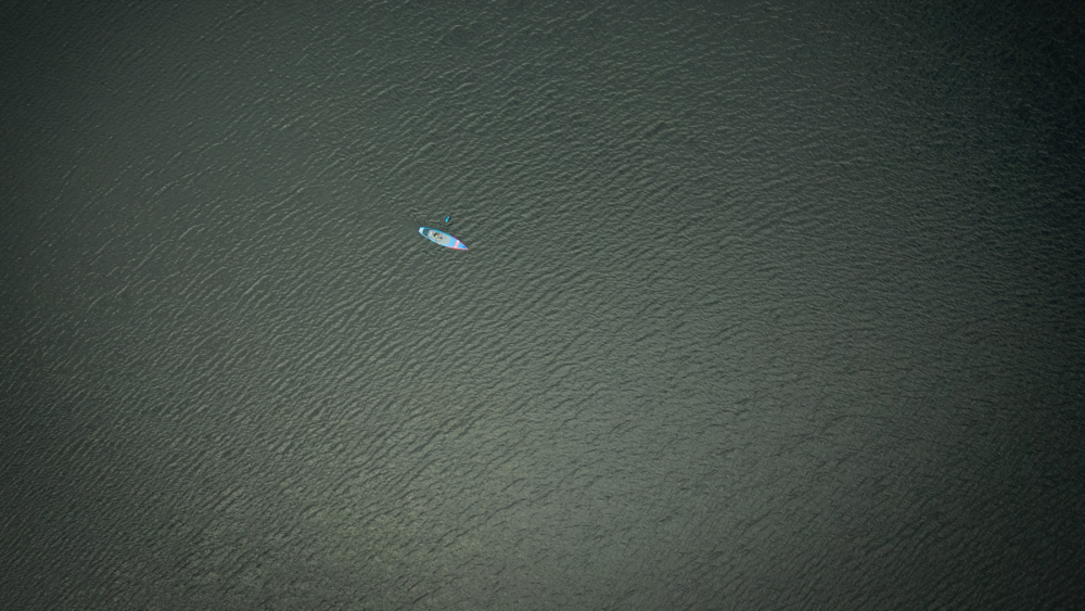
As a photographer, I love exploring both new places and new perspectives along the way. I’m always nudging myself to look at things from a different scale, from the bird’s eye to the fish’s eye.
From above, a river is a testament to centuries of floods and storms. From below, a riverbed tells the tale of geologic time, the tracks of glaciers still clear in the bedrock. At the water’s edge, the banks change day by day and season by season, showing the heartbeat of a river connecting mountains to oceans, centuries to minutes, and us to the landscape.
Source-to-sea adventures like ours are a great way to see firsthand how that connection works. It’s all connected: the salts and minerals from the mountains around the globe are what make the ocean salty. The migratory fish species bring those salts, minerals and nutrients back up into the mountain brooks each year by way of their reproductive cycle. These growing juvenile fish make their way back to the ocean to become part of the larger ocean food cycle.
The more we restore and repair our waterways, the more resilient our rivers and oceans will be for the next generation of humans and wild fish. Stronger, healthier rivers make for stronger and more resilient ecosystems. In turn, these healthy ecosystems make us stronger and healthier and, maybe, a bit wiser.

***
Guest contributor Joe Klementovich is a freelance photographer happiest near any kind of water. Not too many years into an engineering career he realized he would rather be on the bow of a boat or knee deep in a mountain stream than sitting in a cubicle, so dove into photography. Over the years he has worked for The New York Times, Wall Street Journal, Adventure Journal and even The Fly Fish Journal on occasion… Joe keeps his work interesting by taking on projects that run the gamut from Atlantic salmon restoration in Maine to centuries old barns being restored and rebuilt, with a fair bit of chasing fins out on the water. You can find him living in the mountains of New Hampshire not far from a clear cold Brook Trout stream. Dive into more of his work at www.klementovichphoto.com